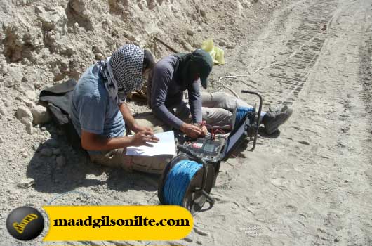
Maad company, in 2015, based on the exploration permit issued by the Ministry of Mines and Minerals, Kermanshah Province Industry, Mining and Trade Organization, started exploration operations for natural bitumen in a part of Maad mine area.
In the early stages of this project, with the help of expert researchers, in the field of geophysics, two-dimensional sampling or in other words, two-dimensional electrical imaging was done.
In this research, when geoelectric operations were carried out in a part of the range, it was found that Gilsonite mineral (natural bitumen) has been replaced from several centimeters to several meters, with alternating thicknesses, in the defined layers of the range.

During the contract concluded with the relevant company in this field, 7 profiles and 750 points were taken in the area by geoelectric method.
also :
– Construction of a trench with dimensions of 20 x 4 x 3 and with a volume of 120 cubic meters in the southeast entrance of Sinhkar.
– Carrying out physical and chemical analyses: Two samples of the existing mineral material have been sent to the relevant laboratory for analysis.
– Preparation of topographic map as well as preparation of geological map
– Preparing the report of discovery operations during mining In the map below, the location of Maad mine (Gol Marjan) is marked on the map.
1- Geophysical investigations indicate the presence of minerals with high specific electrical resistance (anhydrite and bitumen), natural bitumen (as well as minerals with low electrical resistance) green marls.
2- Natural bitumen anomalies and evaporative layers of anhydrite type gypsum with high specific strength related to Gachsaran formations were observed in all the collected profiles. that the arrangement and folding of the layers is in the northwest-southeast direction.
3- In profiles one to four, anomalies with medium to high resistances were introduced under the title of anomaly, natural bitumen (gilsonite) involved in dry anhydrite rock.
4- Several important faults and folds were revealed at the place of taking geophysical profiles. These areas are among the places prone to placing natural bitumen reservoirs.
5- Due to the high quality of natural bitumen available in the area, its specific weight is approximately 1.2.
6- Due to the fact that anomalies, signs of natural bitumen (Gilsonite), are observed at a depth of at least 35 meters, it can be acknowledged that the area in question has the economic potential of natural bitumen, which in order to access this Exploratory drilling of reserves should be continued up to the depth of 80 meters.
Also, after evaluating the natural bitumen reserve, for more accuracy and precision, accurate speculation operation was done by wagon drill and powder drilling.

